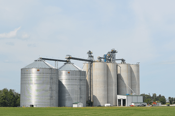
YOUR PARTNER OF CHOICE

The Local Advantage


With 20+ locations across Ohio, a Heritage Cooperative® grain facility is never far away. Between our well-trained employees and well-maintained equipment, our goal is to get you unloaded and back on the road as quickly as possible. Many of our locations are open extra hours during harvest season to keep local combines rolling.

Just as importantly, however, is that your Heritage grain team works for you, our farmer-owners. It’s in our best interest to get you the highest possible price for your grain. Our traders are in the market every day, and bring years of grain marketing experience to bear on your behalf.   

Ask the Expert: Grain

Have a question about grain marketing, pricing strategies or world and national events affecting the grain markets? Send them to us, and read the answers to previous questions here!
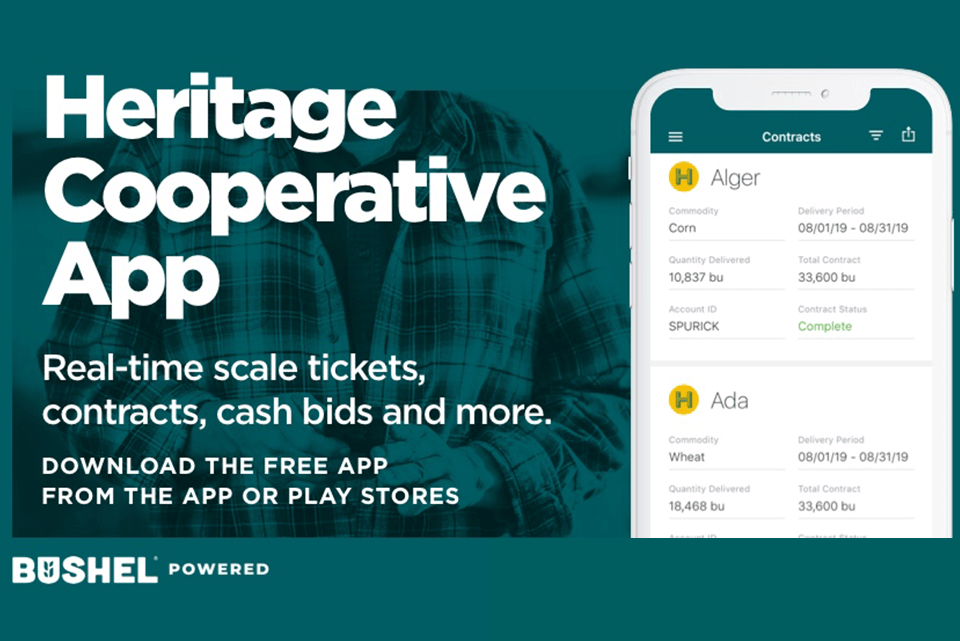
New Grain App

The Heritage Cooperative app provides real-time harvest information to better serve you.

Cash Bids & Futures


@CK4
@CK4
CORN
Symbol Contract Last Open Close High Low Change  
May '24 @C4K May '24 4.5375 4.5700 4.5375 4.5950 4.5375 -0.0325
Jul '24 @C4N Jul '24 4.6700 4.6850 4.6700 4.7200 4.6600 -0.0200
Sep '24 @C4U Sep '24 4.7650 4.7650 4.7650 4.7975 4.7450 -0.0025
Dec '24 @C4Z Dec '24 4.8850 4.8850 4.8850 4.9125 4.8600 0.0000
SOYBEANS
Symbol Contract Last Open Close High Low Change  
May '24 @S4K May '24 12.3225 12.3450 12.3225 12.4050 12.3000 -0.0250
Jul '24 @S4N Jul '24 12.4650 12.4700 12.4650 12.5650 12.4025 -0.0225
Aug '24 @S4Q Aug '24 12.4550 12.4300 12.4550 12.5375 12.3750 -0.0050
Sep '24 @S4U Sep '24 12.2950 12.2125 12.2950 12.3350 12.1625 0.0525
WHEAT
Symbol Contract Last Open Close High Low Change  
May '24 @W4K May '24 6.2475 6.3500 6.2475 6.3500 6.3275 -0.0750
Jul '24 @W4N Jul '24 6.4275 6.4575 6.4275 6.5375 6.3600 -0.0600
Sep '24 @W4U Sep '24 6.6375 6.6600 6.6375 6.7300 6.5600 -0.0475
Dec '24 @W4Z Dec '24 6.8900 6.9050 6.8900 6.9700 6.8100 -0.0425
DTN Click here for info on Exchange delays.

Weather 


72
Sunny
Feels Like
73 F
Humidity
72 %
Dew Point
63 F
Barometer
29.69 inHg
Winds
S 13 mph
Sunrise
06:24 AM
Sunset
08:35 PM

Tue 5/07

Wed 5/08

Thu 5/09

Fri 5/10

Sat 5/11

High

75 F

80 F

64 F

62 F

63 F

Low

56 F

61 F

54 F

46 F

45 F

Precip

80 %

46 %

70 %

41 %

70 %

DTN Cash Bid Updates

Subscribe to receive daily cash bid emails and text messages.

grain_banner

Grain Marketing & Services

There are plenty of options for storing, selling and taking payment for your grain at Heritage Cooperative. You may click on any of the topics listed below, contact our Grain Department. We’d be happy to provide further explanation.

Click each topic for more information

Spot Sale

Spot Sale 

Grain is delivered to the elevator for the current cash price. Unless specified, bushels delivered for cash/spot sale will receive the closing price on the day the grain is delivered.

Fixed Price Contract

Fixed Price Contract 

An agreement that establishes a fixed price, Chicago Board of Trade plus local basis, for a specified amount of grain to be delivered to a named location during an agreed upon delivery period.

Basis Contract

Basis Contract

An agreement that establishes basis, which is the difference between the Chicago Board of Trade and the local cash grain price, for a specified amount of grain for any delivery period and location. The basis is the only fixed portion of the price. A monetary advance can be requested after delivery of the bushels. Final Pricing must be completed prior to an agreed upon expiration date.

Target Price Order

Target Price Order

The customer sets a target price that if hit will result in a fixed price contract or as pricing for delayed price bushels. If the target is hit the contract is written or the delayed price bushels are settled.

Hedge to Arrive Contract

Hedge to Arrive Contract

An agreement that establishes the Chicago Board of Trade price for a specified amount of grain to be delivered to a named location during a specified delivery period. The delivery period cannot exceed 12 months from the contract date. The futures price is the only fixed portion of the price. Final pricing must be completed prior to an agreed upon expiration date or at time of delivery, whichever occurs first. Service fees will apply.

Delayed Price

Delayed Price

Grain can be delivered to the elevator with title passing to Heritage Cooperative. The customer can price the grain for the current market price at a later date.

Open Storage

Open Storage

Grain is delivered to the elevator and title remains with the customer. Open storage is commonly used for government loan programs. Space available for open storage may be limited and storage rates will apply.

Deferred Payment

Deferred Payment

The customer may elect to defer payment for grain delivered against contracts or spot sales. Deferred payment periods are pre-set and current interest rates apply.

Brokerage Service

Brokerage Service

Brokerage services are available for producers interested in setting up hedging accounts for their personal farm operation and risk management practices. The trading of futures and options involves substantial risk of loss and is not suitable for all investors.

grain_marketing

Grain News

DTN Weather Trend Indicators 05/07 07:25

5/7/2024 - 09:03:00

                        GRAIN BELT WX ROUNDUP

Ohio Morning Temperature And Precipitation Summary  
National Weather Service Cleveland Ohio  
819 AM EDT Tue May 7 2024  


Values represent highs yesterday...lows over the last 12 hours  
and precipitation over the last 24 hours ending at 7 AM EST/8 AM EDT.  
     M=Missing Data     T=Trace    NA=Not Available  
:  
.BR CLE 0507 ES DH00/TAIRZX/DH07/TAIRZP/PPDRZZ/SFDRZZ/SDIRZZ  
  
  
:Automated Suface Observation Systems (ASOS) Sites  
:...................................................................  
:          Station          Max  / Min  / 24-HR /  Snow / Snow  
:           Name            Temp / Temp / PCPN  /  Fall / Depth  
:...................................................................  
: ---NORTHWEST OHIO---  
AOH: Lima Allen Apt      :    69 /  53 / 0.00  /   NA  /  NA  
DFI: Defiance Mem Apt    :    67 /  52 / 0.00  /   NA  /  NA  
FDY: Findlay Apt         :    68 /  57 / 0.00  /   NA  /  NA  
TDZ: Toledo Executive Apt:    67 /  54 / 0.00  /   NA  /  NA  
TOL: Toledo Express Apt  :    68 /  51 / 0.00  /  0.0  /   0    
:  
: ---NORTHEAST OHIO---  
CLE: Cleveland Hopkins   :    65 /  52 / 0.00  /  0.0  /   0    
BKL: Burke Lakefront Apt :    61 /  55 / 0.00  /   NA  /  NA  
LPR: Lorain / Elyria Apt :    67 /  51 / 0.00  /   NA  /  NA  
HZY: Northeast Ohio Apt  :    68 /  43 / 0.00  /   NA  /  NA  
CAK: Akron-Canton Apt    :    69 /  55 / 0.00  /  0.0  /   0    
AKR: Akron Fulton Apt    :    72 /  52 / 0.00  /   NA  /  NA  
BJJ: Wooster/Wayne Co Apt:    72 /  56 / 0.00  /   NA  /  NA  
MFD: Mansfield Lahm Apt  :    69 /  55 / 0.00  /  0.0  /   0    
YNG: Youngstown Apt      :    72 /  51 / 0.00  /  0.0  /   0    
:  
: ---SOUTHWEST OHIO---  
LUK: Cincy Lunken Apt    :    76 /  64 / 0.24  /   NA  /  NA  
CVG: Cincy N. Kentucky   :    75 /  63 / 0.42  /    M  /   M    
HAO: Hamilton            :    75 /  63 /    M  /   NA  /  NA  
DAY: Dayton Apt          :    73 /  59 / 0.00  /    M  /   M    
MGY: Wright Bros Apt     :    73 /  63 / 0.02  /   NA  /  NA  
ILN: Wilmington          :    73 /  64 / 0.00  /   NA  /  NA  
:  
: ---CENTRAL AND SOUTHEAST OHIO---  
CMH: John Glenn APT      :    70 /  60 / 1.04  /    M  /   M    
OSU: OSU Apt             :    72 /  59 / 0.03  /   NA  /  NA  
VTA: Newark              :    69 /  59 / 0.01  /   NA  /  NA  
MNN: Marion Apt          :    71 /  57 / 0.00  /   NA  /  NA  
LHQ: Lancaster           :    71 /  62 / 0.01  /   NA  /  NA  
ZZV: Zanesville Apt      :    72 /  62 / 0.02  /   NA  /  NA  
PHD: New Philadelphia    :    70 /  59 / 0.00  /   NA  /  NA  
:  
.END  
  
  
These Data are preliminary and have not undergone final quality   
control by the National Center for Environmental Information (NCEI).   
Therefore...these data are subject to revision. Final and certified   
data can be accessed at www.ncei.noaa.gov.  
  
  
$$  


Max/Min Temperature and Precipitation Table for Indiana  
National Weather Service Indianapolis IN  
845 AM EDT Tue May 7 2024  
  
Values represent highs, lows, precipitation, and snowfall  
the last 24 hours ending at 7:00 a.m. EST/8:00 a.m EDT  
and snow depth at 7:00 a.m. EST/8:00 a.m. EDT.  
  
.BR IND  0507 ES DH00/TAIRZX/DH07/TAIRZP/PPDRZZ/SFDRZZ/SDIRZZ   
:  
:Indiana Temperature and Precipitation Stations  
:................................................................  
:       Station            Max / Min / 24-Hr / Snow / Snow  
:        Name              Temp/ Temp/ Precip/ Fall / Depth  
:................................................................  
:  
:  
EVV  :Evansville         : 78  / 65  / 0.06  /  M   /   M      
FWA  :Fort Wayne         : 68  / 52  / 0.00  /  M   /   M      
IND  :Indianapolis       : 75  / 62  /   T   / 0.0  /   M      
SBN  :South Bend         : 73  / 54  / 0.00  /  M   /   M      
:  
:Automated Surface Observation Stations/Unofficial Data  
BMG  :Bloomington        : 78  / 62  / 0.01  /  M   /   M      
EYE  :Eagle Creek Arpt   : 77  / 63  /   T   /  M   /   M      
GSH  :Goshen             : 70  / 51  / 0.00  /  M   /   M      
LAF  :Lafayette          : 78  / 55  / 0.00  /  M   /   M      
MIE  :Muncie             : 76  / 56  / 0.00  /  M   /   M      
IWX  :Northern IN WFO    : 69  / 54  / 0.00  /  M   /   M      
GEZ  :Shelbyville        : 78  / 63  / 0.01  /  M   /   M      
HUF  :Terre Haute        : 78  / 61  / 0.14  /  M   /   M      
VPZ  :Valparaiso         : 75  / 50  / 0.00  /  M   /   M      
:  
:U.S. Climate Reference Network/Non-Commissioned Site/Unofficial Data  
FPCI3:Oolitic 2.6 WSW    : 75  / 63  / 0.02  /  M   /   M      
:  
:Automated Weather Observing System (AWOS) Stations/Unofficial Data  
AID  :Anderson           : 73  / 64  /   M   /  M   /   M      
ANQ  :Angola             : 66  / 52  /   M   /  M   /   M      
GWB  :Auburn             : 68  / 52  /   M   /  M   /   M      
HLB  :Batesville         : 72  / 59  /   M   /  M   /   M      
BFR  :Bedford            : 73  / 61  /   M   /  M   /   M      
JVY  :Clark Co           : 73  / 63  /   M   /  M   /   M      
CFJ  :Crawfordsville     : 77  / 60  / 0.00  /  M   /   M      
DCY  :Daviess Airport    : 76  / 65  / 0.11  /  M   /   M      
EKM  :Elkhart            : 70  / 51  /   M   /  M   /   M      
FKR  :Frankfort          : 77  / 59  /   M   /  M   /   M      
FRH  :French Lick        : 72  / 63  /   M   /  M   /   M      
GYY  :Gary               : 68  / 55  /   M   /  M   /   M      
GPC  :Greencastle        : 75  / 60  / 0.00  /  M   /   M      
HNB  :Huntingburg        : 76  / 65  / 0.02  /  M   /   M      
HHG  :Huntington         : 69  / 58  /   M   /  M   /   M      
UMP  :Indy Metro         : 76  /  M  / 0.00  /  M   /   M      
OXI  :Knox               : 73  / 54  /   M   /  M   /   M      
OKK  :Kokomo             : 74  / 54  / 0.00  /  M   /   M      
PPO  :LaPorte            : 73  / 50  / 0.00  /  M   /   M      
GGP  :Logansport         : 73  / 52  /   M   /  M   /   M      
IMS  :Madison IN         : 73  / 59  /   M   /  M   /   M      
MZZ  :Marion, IN AWOS    : 72  / 55  / 0.00  /  M   /   M      
MGC  :Michigan City      : 72  / 55  /   M   /  M   /   M      
C65  :Plymouth           : 72  / 55  /   M   /  M   /   M      
RZL  :Rensselear         : 72  / 54  /   M   /  M   /   M      
RID  :Richmond           : 72  / 59  /   M   /  M   /   M      
RCR  :Rochester          : 70  / 55  /   M   /  M   /   M      
ASW  :Warsaw             : 69  / 54  /   M   /  M   /   M      
TYQ  :Zionsville         : 77  / 57  / 0.00  /  M   /   M      
.END  
:  
:Unavailable parameters are indicated by M.  
:  
:The temperature data for AWOS sites represents the highest          
and lowest temperatures that were reported on the metar observations that       
   
transmit three times an hour and may not represent the actual high or          
low for that site. These sites do not measure snowfall or snow depth.  
:  
:These data are preliminary and have not undergone final quality          
control by NCEI. Therefore, these data are subject to revision. Final          
and certified climate data can be accessed at the National Centers          
for Environmental Information /NCEI/ - www.ncdc.noaa.gov.  
  
$$  


Michigan Temperature and Precipitation Summary  
National Weather Service Gaylord MI  
935 AM EDT Tue May 7 2024  
  
       Yesterday's High Temperature  
       12 hour Low Temperature ending at 8 am EDT  
       24 hr Precipitation total ending at 8 am EDT  
       M= Missing Data     T=Trace  
   
.BR APX  0507  ES DH00/TAIRZX/DH07/TAIRZP/PPDRZZ  
:.............................................................  
:                                MAX   MIN    24 HOUR  
:ID    LOCATION                  TEMP  TEMP   PRECIP  
:.............................................................  
:-- Upper Peninsula Stations --  
CMX : Houghton County Airpor :   63 /  45  /  0.00  
P59 : Copper Harbor          :   64 /  48  /  0.00  
IMT : Iron Mountain Airport  :   71 /  40  /  0.00  
MQT : NWS Marquette          :   68 /  46  /  0.00  
IWD : Ironwood Airport       :   74 /  54  /  0.00  
ESC : Escanaba               :   62 /  40  /  0.00  
MNM : Menominee              :   66 /  49  /  0.00  
ERY : Newberry               :   68 /  46  /  0.00  
SAW : Gwinn                  :   68 /  46  /     M   
ANJ : Sault Ste Marie        :   69 /  43  /  0.00  
:-- Northern Lower Peninsula Stations --  
PLN : Pellston               :   72 /  35  /  0.00  
TVC : Traverse City          :   70 /  46  /  0.00  
GLR : Gaylord                :   72 /  44  /  0.00  
APN : Alpena                 :   65 /  34  /  0.00  
HTL : Houghton Lake          :   69 /  34  /  0.00  
:-- Southwest Lower Peninsula Stations --  
GRR : Grand Rapids           :   69 /  50  /  0.00  
LAN : Lansing                :   69 /  45  /  0.00  
MKG : Muskegon               :   75 /  54  /  0.00  
AZO : Kalamazoo              :   73 /  54  /  0.00  
BTL : Battle Creek           :   71 /  54  /  0.00  
BIV : Holland                :    M /   M  /     M  
JXN : Jackson                :   69 /  45  /  0.00  
BEH : Benton Harbor          :   75 /  57  /  0.00  
:-- Southeast Lower Peninsula Stations --  
ADG : Adrian - ASOS          :   69 /  50  /  0.00  
DET : Detroit City - ASOS    :   68 /  48  /  0.00  
DTW : Detroit Metro - ASOS   :   67 /  47  /  0.00  
FNT : Flint - ASOS           :   68 /  39  /  0.00  
PTK : Pontiac - ASOS         :   67 /  42  /  0.00  
MBS : Saginaw - ASOS         :   67 /  41  /  0.00  
WHK : White Lake             :   67 /  41  /  0.00  
.END  
   
These data are preliminary and have not undergone final quality  
control by the National Centers for Environmental Information.  
Therefore...these data are subject to revision.  Final  
and certified climate data can be accessed at www.ncdc.noaa.gov.  
   
$$  
  
  
Max/min Temperatures And Precipitation Table For Southeast And  
South-central Wisconsin  
National Weather Service Milwaukee/Sullivan WI  
732 AM CDT Tue May 7 2024  
  
High temperatures are for the previous 24 hours ending at 1 AM.  
Low temperatures are for the previous 12 hours ending at 7 AM.  
Precipitation is for the previous 24 hours ending at 7 AM.  
  
  
.BR MKE 0507 C DH01/TAIRZX/DH07/TAIRZP/PPDRZZ  
:  
:                                     High Low  Precip  
:                                     Temp Temp  (In.)  
MKE  : Milwaukee                 ASOS: 64 / 49 / 0.00  
MSN  : Madison                   ASOS: 73 / 56 / 0.00  
FLD  : Fond du Lac               ASOS: 72 / 53 / 0.00  
SBM  : Sheboygan                 ASOS: 64 / 43 / 0.00  
ENW  : Kenosha                   ASOS: 67 / 51 / 0.00  
RAC  : Racine                    ASOS: 66 / 51 / 0.00  
LNR  : Lone Rock                 ASOS: 76 / 59 / 0.03  
C35  : Reedsburg                 AWOS: 73 / 57  
DLL  : Baraboo/WI Dells          AWOS: 75 / 58  
UNU  : Juneau                    AWOS: 69 / 51  
ETB  : West Bend                 AWOS: 64 / 46  
MRJ  : Mineral Point             AWOS: 72 / 55  
C29  : Middleton                 AWOS: 73 / 58  
RYV  : Watertown                 AWOS: 70 / 51  
UES  : Waukesha                  AWOS: 64 / 46  
MWC  : Milw.- Timmerman          AWOS: 64 / 50  
EFT  : Monroe                    AWOS: 72 / 57  
JVL  : Janesville                AWOS: 73 / 59  
BUU  : Burlington                AWOS: 67 / 51  
.End  
  
  
These data are preliminary and have not undergone final quality   
control by the National Center for Environmental Information (NCEI).  
Therefore, these data are subject to revision. Final and certified  
climate data can be accessed at: www.ncei.noaa.gov  
  
$$  
  
  
Maximum/Minimum Temperature and Precipitation Table  
National Weather Service Chicago/Romeoville IL  
749 AM CDT Tue May 7 2024  
  
High temperature last 18 hours  
Low temperature last 18 hours  
Precipitation last 24 hours   
   
.BR LOT 0507 C DH01/TAIRZX/DH07/TAIRZP/PPDRZZ  
   
:ID Location                 High   Low     Pcpn  
ORD : Chicago-O'Hare      :   70  /  58  /  0.00  
CNII2: Chi-Northerly Isle :   63  /  55  /  
MDW : Chicago-Midway      :   71  /  60  /  0.00  
LOTI2: NWS Romeoville     :   75  /  59  /  0.00  
RFD : Rockford            :   76  /  61  /  0.00  
DPA : DuPage Airport      :   72  /  58  /  0.00  
UGN : Waukegan            :   65  /  51  /  0.00  
ARR : Aurora Airport      :   74  /  59  /  0.00  
PWK : Wheeling            :   68  /  56  /  0.00  
MLI : Moline              :   78  /  59  /  0.68  
BMI : Bloomington         :   76  /  63  /  0.07  
CMI : Champaign           :   78  /  63  /     T  
DEC : Decatur             :   75  /  63  /  0.09  
LWV : Lawrenceville       :   77  /  66  /  0.52  
ILX : NWS Lincoln         :   73  /  61  /  0.38  
MTO : Mattoon             :   74  /  62  /  0.07  
PIA : Peoria              :   75  /  63  /  0.33  
SPI : Springfield         :   73  /  64  /     M  
CPS : Cahokia             :   78  /  66  /  0.30  
UIN : Quincy              :   72  /  61  /  0.57  
MDH : Carbondale          :   78  /  65  /  0.67  
.END   
  
  
Please note that only the readings for Chicago-O'Hare,  
Rockford, Lincoln, Peoria, Springfield, and Moline are  
to be used for climatological purposes. Other stations  
are supplemental, and should not be used for official  
climatological data.  
   
These data are preliminary and have not undergone final  
quality control by the National Centers for Environmental  
Information (NCEI). Therefore, these data are subject to  
revision. Final and certified climate data can be accessed  
at www.ncei.noaa.gov.  
  
$$  
  
  
Max/Min Temperature And Precipitation Table For Missouri  
National Weather Service St Louis MO  
729 AM CDT Tue May 7 2024  
  
High temperature yesterday  
Low temperature past 12 hours  
24 hour precipitation ending at 6 AM CST/7 AM CDT  
  
  
.BR LSX 0507 CS DH00/TAIRZX/DH06/TAIRZP/PPDRZZ/SFDRZZ/SDIRZZ  
:...............................................................  
:       Station            | Max | Min | 24-hr  | Snow | Snow  |  
:        Name              | Tmp | Tmp | Precip | Fall | Depth |  
:...............................................................  
:  
CGI  :  Cape Girardeau     :  79 / 69  / 0.95   /      /       
SUS  :  Chesterfield       :  76 / 62  / 0.63   /      /       
CDJ  :  Chillicothe        :  75 /  M  / 0.59   /      /       
COU  :  Columbia           :  78 / 60  / 0.57   /  0.0 /    0  
FAM  :  Farmington         :  79 / 63  / 0.48   /      /       
JEF  :  Jefferson City     :  80 / 62  / 0.71   /      /       
JLN  :  Joplin Aprt        :  79 / 62  / 0.26   /      /       
MKC  :  Kansas City Dwtn   :  76 / 57  / 0.76   /      /       
MCI  :  Kansas City Intl   :  75 / 56  / 0.92   /  0.0 /    0  
IRK  :  Kirksville         :  71 / 54  / 0.71   /      /       
AIZ  :  Osage Beach Aprt   :  78 / 60  / 0.00   /      /       
POF  :  Poplar Bluff       :  79 / 71  / 0.29   /      /       
VIH  :  Rolla/Vichy Aprt   :  77 / 61  / 0.55   /      /       
DMO  :  Sedalia            :  78 / 59  / 1.03   /      /       
SGF  :  Springfield Natl A :  78 / 60  / 1.16   /  0.0 /    0  
SET  :  St. Charles        :  77 / 63  / 0.59   /      /       
STJ  :  St. Joseph         :  75 / 54  / 0.54   /      /       
STL  :  St. Louis          :  79 / 64  / 0.27   /  0.0 /    0  
UNO  :  West Plains Aprt   :  77 / 63  / 1.11   /      /       
.END  
  
  
These data are preliminary and have not undergone final quality  
control by the National Centers for Environmental Information (NCEI).  
Therefore, these data are subject to revision. Final and certified   
data can be accessed at www.ncei.noaa.gov.  
  
  
$$  


Max/Min Temperature and Precipitation Table for Central Iowa  
National Weather Service Des Moines IA  
722 AM CDT Tue May 7 2024  
  
.BR DMX 0507 CS DH00/TAIRZX/DH06/TAIRZP/PPDRZZ/SFDRZZ/SDIRZZ  
  
: Values represent highs yesterday...12-hour lows and 24-hour  
:  precipitation as of 6 AM CST / 7 AM CDT.  
:  
:                                         Max   Min                Snow  
:       Location                         Temp  Temp   Pcpn   Snow Depth  
:  
: Automated sites--Automated Surface Observing System (ASOS), WFO DMX  
:  and FOD Automated Weather Observation Station (AWOS)  
:  
AMW   : Ames ASOS                      :  75 /  54 /  1.89 /    M /   M  
DSM   : Des Moines ASOS                :  75 /  56 /  0.88 /    M /   M  
EST   : Estherville ASOS               :  72 /  51 /  0.90 /    M /   M  
FOD   : Fort Dodge AWOS                :  74 /  53 /  0.39 /    M /   M  
LWD   : Lamoni ASOS                    :  73 /  53 /  0.93 /    M /   M  
MIW   : Marshalltown ASOS              :  76 /  55 /  0.41 /    M /   M  
MCW   : Mason City ASOS                :  74 /  53 /  0.89 /    M /   M  
DMX   : NWS Johnston*                  :  73 /  54 /  1.50 /  0.0 /   0  
OTM   : Ottumwa ASOS                   :  72 /  55 /  0.38 /    M /   M  
ALO   : Waterloo ASOS                  :  77 /  56 /  0.73 /    M /   M  
:  
:* Cooperative weather observation site  
:  
: Automated sites--Automated Weather Observing System (AWOS)  
  
AXA   : Algona AWOS                    :  73 /  54 /  1.13 /    M /   M  
IKV   : Ankeny AWOS                    :  72 /  55 /  0.91 /    M /   M  
AIO   : Atlantic AWOS                  :  73 /  52 /  1.10 /    M /   M  
ADU   : Audubon AWOS                   :  73 /  52 /  1.33 /    M /   M  
BNW   : Boone AWOS                     :  72 /  52 /  1.11 /    M /   M  
CIN   : Carroll AWOS                   :  73 /  54 /  0.90 /    M /   M  
CNC   : Chariton AWOS                  :  70 /  54 /  0.52 /    M /   M  
CAV   : Clarion AWOS                   :  75 /  54 /  0.64 /    M /   M  
CSQ   : Creston AWOS                   :  72 /  52 /  1.34 /    M /   M  
DNS   : Denison AWOS                   :  73 /  54 /  1.19 /    M /   M  
FXY   : Forest City AWOS               :  72 /  54 /  0.97 /    M /   M  
GGI   : Grinnell AWOS                  :  75 /  56 /  0.57 /    M /   M  
HPT   : Hampton AWOS                   :  72 /  52 /  0.50 /    M /   M  
IFA   : Iowa Falls AWOS                :  75 /  55 /  0.47 /    M /   M  
OXV   : Knoxville AWOS                 :  72 /  55 /  0.59 /    M /   M  
TNU   : Newton AWOS                    :  73 /  55 /  0.43 /    M /   M  
I75   : Osceola AWOS                   :  73 /  54 /  0.56 /    M /   M  
PEA   : Pella AWOS                     :  73 /  55 /  0.40 /    M /   M  
PRO   : Perry AWOS                     :  76 /  53 /  1.09 /    M /   M  
EBS   : Webster City AWOS              :  73 /  54 /  0.11 /    M /   M  
:  
: Other automated sites--including Climate Reference Network (CRN),  
:  Iowa State University Soil Moisture (ISUSM), Remote Automated  
:  Weather Stations (RAWS) and Roadway Weather Information System  
:  (RWIS)  
  
RDAI4 : Adair I-80 RWIS                :  72 /  51 /     M /    M /   M  
RALI4 : Algona US 18 RWIS              :  73 /  52 /     M /    M /   M  
BOOI4 : Ames AEA-RDF ISUSM             :  72 /  53 /  2.47 /    M /   M  
AMFI4 : Ames Finch Farm ISUSM          :  74 /  54 /  2.14 /    M /   M  
AHDI4 : Ames Hinds Farm ISUSM          :  74 /  54 /  2.63 /    M /   M  
AKCI4 : Ames Kitchen Farm ISUSM        :  73 /  53 /     M /    M /   M  
RAKI4 : Ankeny I-35 RWIS               :  73 /  55 /     M /    M /   M  
RBFI4 : Bedford IA 2 RWIS              :  72 /  51 /     M /    M /   M  
RCAI4 : Carroll US 30 RWIS             :  58 /  58 /     M /    M /   M  
RCNI4 : Centerville IA 2 RWIS          :  72 /  60 /     M /    M /   M  
CHAI4 : Chariton McNay ISUSM           :  72 /  53 /  0.89 /    M /   M  
RCFI4 : Colfax I-80 RWIS               :  75 /  55 /     M /    M /   M  
RCEI4 : Creston US 34 RWIS             :  73 /  52 /     M /    M /   M  
RDNI4 : Denison US 59 RWIS             :  66 /  51 /     M /    M /   M  
RDSI4 : Des Moines I-35 RWIS           :  73 /  55 /     M /    M /   M  
RDMI4 : Des Moines I-235 RWIS          :  73 /  57 /     M /    M /   M  
ERYI4 : Early US 20/US 71 RWIS         :  71 /  53 /     M /    M /   M  
RDYI4 : Eddyville IA 137 RWIS          :  73 /  57 /     M /    M /   M  
RETI4 : Estherville Hwy 9 RWIS         :  71 /  51 /     M /    M /   M  
RFDI4 : Fort Dodge US 20 RWIS          :  73 /  53 /     M /    M /   M  
RGAI4 : Granger IA 141 RWIS            :  73 /  54 /     M /    M /   M  
GREI4 : Greenfield Neely Kinyon ISUSM  :  74 /  52 /  3.91 /    M /   M  
RGRI4 : Grinnell I-80 RWIS             :  72 /  60 /     M /    M /   M  
RHAI4 : Hanlontown I-35 RWIS           :  74 /  54 /     M /    M /   M  
DOCI4 : Jefferson Deals Orchard ISUSM  :  73 /  52 /  0.24 /    M /   M  
RJFI4 : Jefferson IA 4 RWIS            :  76 /  53 /     M /    M /   M  
KNAI4 : Kanawha ISUSM                  :  75 /  52 /  1.70 /    M /   M  
RLEI4 : Leon IA 2 RWIS                 :  77 /  54 /     M /    M /   M  
SSFI4 : Lucas/Stephens SF RAWS         :  74 /  52 /  0.81 /    M /   M  
RMTI4 : Marshalltown US 30 RWIS        :  76 /  55 /     M /    M /   M  
RMCI4 : Mason City I-35 RWIS           :  73 /  53 /     M /    M /   M  
NSSI4 : Neal Smith NWR CRN             :  73 /  53 /  0.53 /    M /   M  
NSWI4 : Neal Smith NWR RAWS            :  72 /  54 /  0.55 /    M /   M  
ROSI4 : Osceola I-35 RWIS              :  75 /  54 /     M /    M /   M  
OSTI4 : Oskaloosa Tassel Ridge ISUSM   :  74 /  56 /  0.53 /    M /   M  
ROTI4 : Ottumwa US 63 RWIS             :  74 /  61 /     M /    M /   M  
RPFI4 : Plainfield US 218 RWIS         :  73 /  57 /     M /    M /   M  
RRWI4 : Rockwell City US 20/IA 4 RWIS  :  73 /  52 /     M /    M /   M  
RSBI4 : Steamboat Rock US 20 RWIS      :  74 /  54 /     M /    M /   M  
RWII4 : Williams I-35 RWIS             :  76 /  54 /     M /    M /   M  
.END  
  
These data are preliminary and have not undergone final quality  
control /QC/ by NCEI. Therefore, these data are subject to revision.  
Final and certified climate data can be accessed at the National  
Centers for Environmental Information /NCEI/ - www.ncei.noaa.gov.  
  
$$  


State Temperature And Precipitation Summary  
National Weather Service Bismarck ND  
725 AM CDT Tue May 7 2024  
  
.BR BIS 0507 C DH01/TAIRZX/DH07/TAIRZP/PPDRZZ/SFDRZZ/SDIRZZ  
:  
:VALUES REPRESENT YESTERDAY'S HIGHS...LOWS OVER THE LAST 12 HOURS  
:AND PRECIPITATION FOR THE PAST 24 HOURS ENDING AT 7 AM CDT.  
:ASOS SITES ARE AUTOMATED AND MAY UNDER-ESTIMATE WINTER PRECIP.  
:  
:CENTRAL TIME ZONE STATIONS  
:................................................................  
:       STATION              MAX / MIN  / 24-HR  / SNOW / SNOW  
:        NAME                TEMP/ TEMP / PRECIP / FALL / DEPTH  
:................................................................  
:  
: CENTRAL TIME ZONE STATIONS  
.BR BIS 0507 C DH01/TAIRZX/DH07/TAIRZP/PPDRZZ/SFDRZZ/SDIRZZ  
BIS  : Bismarck ASOS      :  62  /  50  /  0.23 /   0.0 /   0  
JMS  : Jamestown FAA      :  71  /  54  /  0.38 /    M  /   M   
MOT  : Minot FAA          :  60  /  51  /  0.04 /    M  /   M   
XWA  : Williston Basin Air:  58  /  50  /  0.74 /    M  /   M   
N60  : Garrison ASOS      :  57  /  52  /  0.17 /    M  /   M   
MIB  : Minot Air Force Bas:  60  /  52  /  0.05 /    M  /   M   
GFK  : ASOS @ Grand Forks :  74  /  55  /  0.17 /   0.0 /   0  
FAR  : ASOS @ Fargo Airpor:  77  /  57  /  0.11 /   0.0 /   0  
DVL  : AWOS @ Devils Lake :  66  /  50  /  0.08 /    M  /   M   
.END  
: MOUNTAIN TIME ZONE STATIONS  
.BR BIS 0507 M DH00/TAIRZX/DH06/TAIRZP/PPDRZZ/SFDRZZ/SDIRZZ  
DIK  : Dickinson Theodore :  58  /  40  /  0.04 /    M  /   M   
HEI  : Hettinger ASOS     :  64  /  41  /    T  /    M  /   M   
.END  
  
  
 These data are preliminary and have not undergone final quality  
 control by the National Center for Environmental Information /NCEI/.  
 Therefore these data are subject to revision. Final and certified  
 climate data can be accessed at www.ncdc.noaa.gov.  
  
  
$$  


Max/Min Temperature and Precipitation Table For SD  
National Weather Service Sioux Falls SD  
740 AM CDT Tue May 7 2024  
  
Values represent Highs yesterday...Lows over the last 12 hours  
and Precipitation over the last 24 hours  
  
.BR FSD 0507 C DH01/TAIRZXZ/DH07/TAIRZPZ/PPDRZZZ/SFDRZZ/SDIRZZZ   
:  
: Locations in Central Time Zone...  
:  
:                         MAX     MIN             SNOW  SNOW  
:ID    LOCATION           TEMP    TEMP     PCPN   FALL DEPTH  
:  
ABR  :Aberdeen         :  70   /   52   /  0.11 /  0.0/   0   
BKX  :Brookings SD     :  70   /   52   /    M  /   M /   M   
9V9  :Chamberlain SD   :  65   /   49   /    M  /   M /   M   
HON  :Huron Airport    :  68   /   50   /  0.17 /  0.0/   0   
MDS  :Madison SD       :  68   /   48   /    M  /   M /   M   
MHE  :Mitchell ASOS    :  68   /   51   /  0.26 /  0.0/   0   
MBG  :Mobridge AP      :  65   /   47   /  0.19 /  0.0/   0   
PIR  :Pierre Regional A:  68   /   48   /  0.21 /  0.0/   0   
FSD  :Sioux Falls Airpo:  72   /   52   /  0.72 /  0.0/   0   
8D3  :Sisseton AP      :  71   /   55   /  1.03 /  0.0/   0   
ATY  :Watertown Regiona:  68   /   52   /  1.22 /  0.0/   0   
ICR  :Winner AP        :  69   /   49   /  0.01 /   M /   M   
YKN  :Yankton SD       :  68   /   51   /    M  /   M /   M   
  
.End  
  
:  
: Locations in Mountain Time Zone...  
:  
:                         MAX     MIN             SNOW  SNOW  
:ID    LOCATION           TEMP    TEMP     PCPN   FALL DEPTH  
:  
2WX  :  Buffalo          :  71   /   43   / 0.15 /  M /   M   
CUT  :  Custer AP        :  54   /   32   / 0.38 /  M /   M   
D07  :  Faith AP         :  69   /   42   / 1.19 /  M /   M   
PHP  :  Philip AP        :  77   /   46   / 0.03 /  M /   M   
IEN  :  Pine Ridge AP    :  70   /   43   / 0.10 /  M /   M   
UNRS2:  Rapid City NWS   :  71   /   44   /   T  / 0.0/   0   
RAP  :  Rapid City AP    :  71   /   47   / 0.06 /  M /   M   
  
.End  
  
These data are preliminary and have not undergone final quality control  
by the National Centers for Environmental Information /NCEI/.  
Therefore...these data are subject to revision. Final and certified  
climate data can be accessed at www.ncdc.noaa.gov.  
  
$$  
  
  
Max/Min Temperature and Precipitation Table for Nebraska  
National Weather Service Hastings NE  
730 AM CDT TUE MAY 07 2024  
  
: Values represent yesterday's highs, lows over the last 12 hours  
: and precipitation the last 24 hours ending at 7 am CDT (6 am MDT).  
  
.BR GID 0507 C DH01/TAIRZX/DH07/TAIRZP/PPDRZZ/SFDRZZ/SDIRZZ  
:  
:                                                 Snow   Snow  
:       Station              Max / Min  / Pcpn  / Fall / Depth  
:  
ANW  :  Ainsworth Airport :   67 /  48  / 0.10  /      /      
BVN  :  Albion Airport    :   64 /  46  / 0.46  /      /      
AIA  :  Alliance          :   65 /  40  / 0.05  /      /      
AUH  :  Aurora Airport    :   63 /  46  / 0.44  /      /      
BIE  :  Beatrice Airport  :   67 /  46  / 0.28  /      /      
BTA  :  Blair Airport     :   73 /  51  / 0.87  /      /      
BBW  :  Broken Bow Airport:   68 /  45  / 0.03  /      /      
CDR  :  Chadron           :   66 /  42  / 0.12  /      /      
OLU  :  Columbus Airport  :   65 /  47  / 0.10  /      /      
FNB  :  Falls City Airport:   74 /  51  / 2.21  /      /      
FET  :  Fremont Airport   :   69 /  49  / 1.13  /      /      
GRN  :  Gordon Airport    :   70 /  41  /    M  /      /      
GRI  :  Grand Island Arpt :   64 /  46  / 0.28  /  0.0 /   0  
HSI  :  Hastings Airport  :   64 /  47  / 0.37  /  0.0 /   0  
HJH  :  Hebron Airport    :   67 /  45  / 0.09  /      /      
HDE  :  Holdrege Airport  :   65 /  46  / 0.01  /      /      
IML  :  Imperial Airport  :   74 /  45  / 0.00  /      /      
EAR  :  Kearney Airport   :   62 /  47  / 0.01  /      /      
IBM  :  Kimball Airport   :   56 /  41  /    T  /      /      
LXN  :  Lexington Airport :   74 /  50  /    T  /      /      
LNK  :  Lincoln Airport   :   69 /  46  / 0.85  /  0.0 /   0  
MCK  :  McCook Airport    :   80 /  49  / 0.00  /      /      
AFK  :  Nebraska City Arpt:   70 /  51  / 1.10  /      /      
OFK  :  Norfolk Airport   :   65 /  47  / 0.36  /  0.0 /   0  
LBF  :  North Platte Arpt :   79 /  50  / 0.00  /  0.0 /   0  
OFF  :  Offutt AFB        :   74 /  52  / 0.64  /      /      
OGA  :  Ogallala Airport  :   72 /  40  / 0.00  /      /      
OMA  :  Omaha/Eppley      :   75 /  52  / 0.58  /  0.0 /   0  
MLE  :  Omaha/Millard     :   70 /  50  / 0.67  /      /      
ONL  :  O'Neill Airport   :   63 /  48  / 0.01  /      /      
ODX  :  Ord Airport       :   63 /  42  / 0.06  /      /      
PMV  :  Plattsmouth Arpt  :   73 /  53  / 0.60  /      /      
BFF  :  Scottsbluff       :   61 /  45  / 0.07  /      /      
SNY  :  Sidney            :   64 /  44  /    T  /      /      
TQE  :  Tekamah Airport   :   74 /  53  / 0.84  /      /      
TIF  :  Thedford Airport  :   78 /  46  / 0.01  /      /      
VTN  :  Valentine Airport :   75 /  48  / 0.23  /  0.0 /   0  
OAX  :  Valley NWS Office :   70 /  51  / 0.90  /  0.0 /   0  
AHQ  :  Wahoo Airport     :   67 /  48  / 0.71  /      /      
LCG  :  Wayne Airport     :   65 /  48  /    M  /      /      
JYR  :  York Airport      :   63 /  45  / 0.46  /      /      
   
   
:   State Temperature Extremes  
:  
:   80 degrees at...McCook Airport  
:   40 degrees at...Alliance, Ogallala Airport  
:  
.END  
  
These data are preliminary and have not undergone final quality  
control by the National Centers for Environmental Information (NCEI).  
Therefore, these data are subject to revision. Final and certified  
climate data can be accessed at www.ncei.noaa.gov.  
  
$$  
REED  


Supplemental Temperature and Precipitation Table  
National Weather Service Topeka Kansas  
715 AM CDT Tue May 07 2024  
  
Values represent highs yesterday, lows over the last 12 hours  
and precipitation over the last 24 hours.  
  
Snow depth is measured daily and is valid as of 07 AM CDT.  
.BR TOP 0507 C DH01/TAIRZX/DH07/TAIRZP/PPDRZZ/SFDRZZ/SDIRZZ  
:  
:Kansas  
:Temperature and precipitation stations  
:................................................................   
:       Station              Max / Min  / 24-hr   / Snow  /  Snow   
:        Name                Temp/ Temp / Pcpn    / Fall  /  Depth   
:................................................................  
:Kansas  
:  
TOP  : Topeka Billard Arpt :  75 /  54 /  0.03 /   0.0 /    0  
CNK  : Concordia Airport   :  70 /  51 /  0.58 /   0.0 /    0  
FOE  : Topeka Forbes Field :  73 /  53 /  0.02 /     M /    M  
LWC  : Lawrence Airport    :   M /  53 /  1.30 /   0.0 /    0  
MHK  : Manhattan Airport   :  74 /  44 /  0.50 /   0.0 /    0  
EMP  : Emporia Airport     :  74 /  52 /  0.02 /   0.0 /    0  
MYZ  : Marysville Airport  :  68 /  45 /       /     M /    M  
K78  : Abilene Airport     :  72 /  45 /       /     M /    M  
OWI  : Ottawa Airport      :   M /   M /       /     M /    M  
UKL  : Burlington Airport  :  75 /  69 /       /     M /    M  
:  
.END  
  
.BR TOP 0507 C DH07/TAIRZX/TAIRZN/PPDRZZ/SFDRZZ/SDIRZZ  
:  
:Kansas Cooperative Weather Observer  
:Temperature and Precipitation Reports  
:Values are for the past 24 hours ending between 6 am and 8 am.  
:.................................................................   
:      Station           Report  Max / Min  / 24-hr  /  Snow / Snow   
:       Name              Time   Temp  Temp /  Pcpn  /  Fall / Depth   
:.................................................................  
:  
CPMK1:  Chapman         : DH0500/  71 /  47  /  0.40  /   0.0 /   0  
CCRK1:  Clay Center     : DH0700/  69 /  47  /  1.10  /     M /   M  
MLFK1:  Milford Lake    : DH0700/  71 /  47  /  0.52  /     M /   M  
BRPK1:  Blue Rapids     : DH0700/     /      /  0.60  /     M /   M  
BRMK1:  Bremen 1E       : DH0700/     /      /  0.66  /     M /   M  
CONK1:  Concordia 2SE   : DH0635/     /      /  0.63  /     M /   M  
EPRK1:  Emporia 3NW     : DH0600/     /      /     M  /     M /   M  
FRVK1:  Fairview        : DH0700/     /      /  1.43  /     M /   M  
GRDK1:  Gridley         : DH0700/     /      /  1.35  /     M /   M  
MCFK1:  McFarland       : DH0700/     /      /  0.02  /   0.0 /   0  
NTVK1:  Nortonville     : DH0400/     /      /  0.15  /     M /   M  
KOAK1:  Onaga 2NW       : DH0600/     /      /  0.92  /   0.0 /   0  
TFOK1:  Topeka-NWS      : DH0600/     /      /  0.03  /   0.0 /   0  
WTCK1:  White City 2NE  : DH0702/     /      /  0.04  /   0.0 /   0  
WILK1:  Wilsey 1NNE     : DH0650/     /      /  0.11  /     M /   M  
:  
.END  
  
These data are preliminary and have not undergone final quality  
control by the National Centers for Environmental Information. These   
data are subject to revision. Final and certified data can be   
accessed at www.ncei.noaa.gov.  
  
$$  
  
  
Colorado Temperature And Precipitation Table  
National Weather Service Pueblo CO  
629 AM MDT Tue May 7 2024  
  
High temperature yesterday  
Low temperature past 12 hours  
24 hour precipitation ending at 6AM MDT  
Snow depth at 6AM MDT  
.B DEN 240507 M DH06/TX/TN/PP/SD  
  
  
: ...Colorado...  
:                                                 Snow  
:                           High   Low     Pcpn  Depth  
AKO   : Akron            :   62  /  31  /  0.00 /   M  
ALS   : Alamosa          :   56  /  23  /  0.00 /   0  
ASE   : Aspen            :   41  /  30  /  0.01 /   M  
ITR   : Burlington       :   69  /  36  /  0.00 /   M  
APA   : Centennial Arpt  :   61  /  36  /  0.00 /   M  
COS   : Colorado Springs :   60  /  44  /  0.00 /   0  
CEZ   : Cortez           :   58  /  26  /  0.00 /   M  
CAG   : Craig            :   40  /  26  /  0.03 /   M  
DEN   : Denver Intl Arpt :   64  /  45  /  0.00 /   M  
DRO   : Durango          :   55  /  22  /  0.00 /   M  
EGE   : Eagle            :   51  /  33  /     M /   M  
FNL   : Ft Collins Arpt  :   62  /  40  /  0.00 /   M  
GJT   : Grand Junction   :   61  /  42  /  0.00 /   0  
GXY   : Greeley Airport  :   64  /  39  /  0.00 /   M  
GUC   : Gunnison         :   48  /  31  /     M /   M  
HDN   : Hayden           :   45  /  30  /     M /   M  
LHX   : La Junta         :   69  /  42  /  0.00 /   M  
LAA   : Lamar            :   73  /  35  /  0.00 /   M  
LXV   : Leadville        :   42  /  22  /  0.11 /   M  
LIC   : Limon            :   62  /  29  /  0.00 /   M  
EEO   : Meeker           :   41  /  24  /  0.04 /   M  
MTJ   : Montrose         :   55  /  37  /  0.00 /   M  
PUB   : Pueblo           :   69  /  37  /  0.00 /   0  
RIL   : Rifle            :   55  /  35  /     T /   M  
SPD   : Springfield      :   75  /  38  /  0.00 /   M  
TEX   : Telluride        :   39  /  32  /     M /   M  
TAD   : Trinidad         :   68  /  39  /  0.00 /   M  
  
.END  
From the above reports  
  
The highest temperature in Colorado yesterday was 75 degrees   
in Springfield.  
  
The lowest temperature in Colorado during the past 12 hours   
was 22 degrees in Durango and Leadville.  
  
$$  
  
  
Texas Temperature and Precipitation Table  
National Weather Service Lubbock TX  
719 AM CDT Tue May 7 2024  
  
Data Through 7 AM CDT  
Values represent Highs yesterday...Lows over the last 12 Hours  
and Precipitation over the last 24 hours  
  
.BR LUB  0507 C DH00/TAIRZX/DH06/TAIRZP/PPDRZZ   
:  
:ID   LOCATION                 HIGH  LOW    PCPN  
:                                           24HR  
:...NORTH TEXAS...  
 ABI : Abilene ASOS          :  86  /  64 /   0   
 GKY : Arlington             :  85  /  73 /     T    
 CRS : Corsicana             :  85  /  75 /   0.02   
 DAL : Dallas Love Field     :  85  /  74 /     T    
 DFW : DFW Airport           :  84  /  73 /     T    
 DTO : Denton                :  84  /  70 /     T    
 AFW : Fort Worth Alliance   :  84  /  73 /   0   
 FTW : Fort Worth Meacham    :  85  /  71 /   0   
 GGG : Longview              :  85  /  75 /   0   
 LFK : Lufkin                :  85  /  75 /   0   
 TKI : McKinney              :  82  /  75 /     T    
 MWL : Mineral Wells         :  85  /  71 /   0   
 PRX : Paris                 :  81  /  73 /     T    
 TPL : Temple                :  84  /  71 /   0   
 TRL : Terrell               :  82  /  73 /     T    
 TYR : Tyler                 :  86  /  75 /   0   
 ACT : Waco                  :  85  /  72 /     T    
 SPS : Wichita Falls Municipa:  87  /  57 /     T    
:...WEST TEXAS...  
 AMA : Amarillo              :  84  /  49 /   0   
 HHF : Canadian Airport      :  87  /  59 /   0   
CTLT2: Castolon-Big Bend NP  :  104 /  70 /   0   
 CDS : Childress             :  94  /  50 /   0   
 DHT : Dalhart               :  80  /  43 /   0   
 6R6 : Dryden                :  96  /  70 /   0   
 ELP : El Paso               :  87  /  67 /   0   
 FST : Fort Stockton         :  96  /  66 /   0   
 LBB : Lubbock               :  92  /  53 /   0   
 MRF : Marfa                 :  87  /  51 /   0   
 MAF : Midland               :  92  /  54 /   0   
MUST2: Muleshoe              :  86  /  39 /   0   
 ODO : Odessa                :  93  /  56 /   0   
 PEQ : Pecos                 :  94  /  65 /   0   
 PRS : Presidio              :  97  /  66 /   0   
 SJT : San Angelo ASOS       :  92  /  71 /   0   
 INK : Wink                  :  94  /  62 /   0   
:...SOUTH TEXAS...  
 ALI : Alice                 :  86  /  76 /   0   
 ATT : Austin Mabry          :  87  /  73 /   0   
 AUS : Austin Bergstrom      :  87  /  73 /     T    
 BPT : Beaumont              :  85  /  76 /     T    
 BRO : Brownsville           :  91  /  81 /   0   
 BMQ : Burnet                :  85  /  69 /   0   
 CLL : College Station       :  88  /  75 /   0.01   
 CXO : Conroe                :  86  /  76 /   0   
 CRP : Corpus Christi        :  87  /  79 /     T    
 NGP : Navy Corpus           :  90  /  83 /   0   
 COT : Cotulla               :  91  /  77 /   0   
 DRT : Del Rio               :  95  /  78 /   0   
 GLS : Galveston             :  82  /  77 /   0   
 GTU : Georgetown            :  87  /  72 /     T    
 HRL : Harlingen             :  91  /  78 /   0   
 HDO : Hondo                 :  90  /  73 /     M    
 HOU : Houston Hobby         :  87  /  78 /     T    
 IAH : Houston Bush          :  85  /  78 /     T    
 UTS : Huntsville            :  85  /  76 /   0   
 JCT : Junction ASOS         :  90  /  77 /   0   
 NQI : Kingsville            :  90  /  80 /   0   
 LRD : Laredo                :  96  /  76 /   0   
 MFE : McAllen               :  94  /  79 /     T    
 BAZ : New Braunfels         :  89  /  73 /   0   
 PSX : Palacios              :  83  /  78 /     T    
 LVJ : Pearland              :  84  /  78 /     T    
 RKP : Rockport              :  88  /  79 /   0   
 SAT : San Antonio           :  87  /  75 /     T    
 SSF : San Antonio Stinson   :  87  /  73 /   0   
 HYI : San Marcos            :  87  /  71 /   0   
 DWH : Tomball               :   M  /  M  /     M    
 VCT : Victoria              :  90  /  77 /   0   
:...OTHERS...  
 TXK : Texarkana             :  86  /  75 /   0   
.END  
  
Texas Temperature Extremes:  
Highest...104 at Castolon  
Lowest.... 39 at Muleshoe  
  
 These data are preliminary and have not undergone final  
 quality control by the National Centers for Environmental  
 Information /NCEI/. Therefore these data are subject to  
 revision. Final and certified Climate Data can be accessed  
 at www.ncei.noaa.gov.  
  
$$


Market Commentary

Understand how the latest news and world events are likely to affect U.S. grain markets. Our grain specialists weigh in weekly. 

Regional Grain Branches

Kenton Grain
800-288-2318

Upper Sandusky Grain
800-686-9278

Urbana Grain
800-424-2584

Mechanicsburg Grain
937-834-2416

Marysville Ag Campus
937-642-3841

Canfield Region
800-772-7707

Locations